
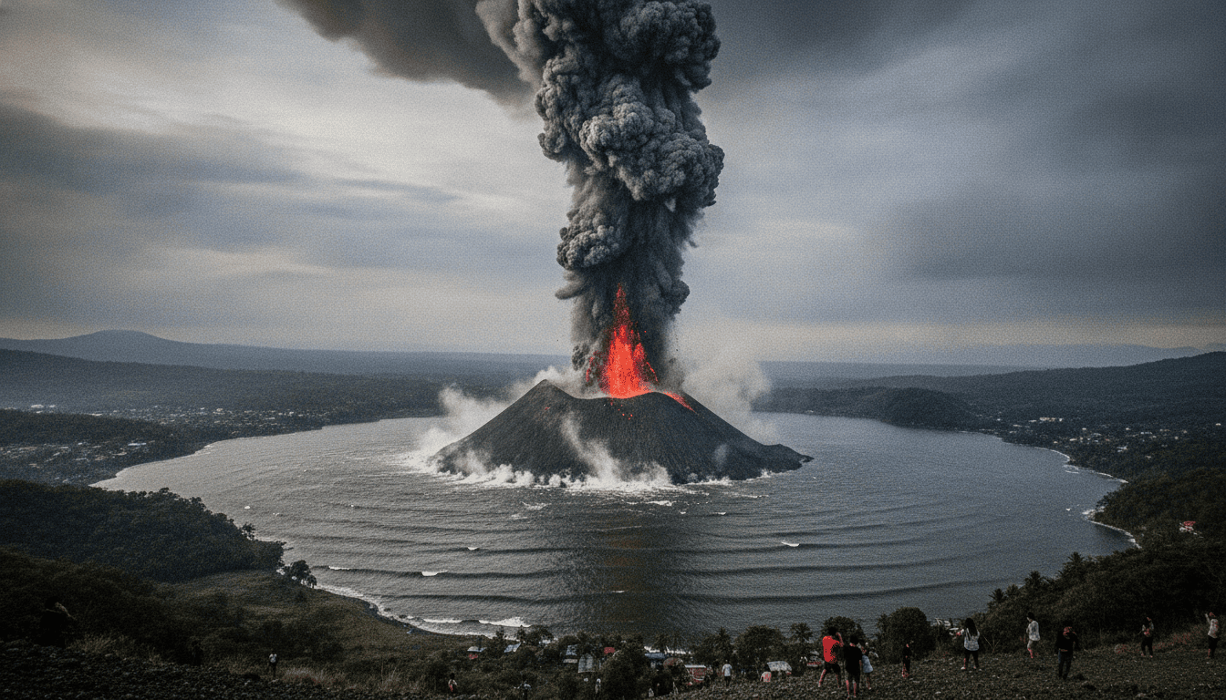
Taal Volcano eruption sends 1,200m ash column and triggers large crater-lake waves
Taal Volcano eruption on July 2, 2026 sent ash and steam 1,200 meters skyward and produced large crater-lake waves; video captured the nearly five-minute event.
Eruption captured in footage
A dramatic video recorded the Taal Volcano eruption on July 2, 2026, showing a column of ash and steam rising about 1,200 metres above the volcano’s crater. The footage, shared widely on social platforms, shows strong steam pulses and a sequence of explosive bursts that continued for almost five minutes. Observers reported seeing the plume darken the sky over the immediate area and generating visible disturbances across the crater lake.
Crater lake thrown into motion
The eruption produced large waves that swept across Taal’s crater lake, visible in multiple clips from the scene. Those waves surged against the crater rim and stirred water and debris, creating further splashes of steam and ash as they moved. The lake response underscores the shallow, water-filled nature of Taal’s active vent, where interactions between magma and water can amplify surface disturbances.
Local reaction and eyewitness accounts
Residents and visitors near the volcano posted videos and first-hand accounts after the event, conveying alarm and curiosity about the scale of the blast. Many described a sudden roar followed by a rapid rise of ash and steam, prompting some people to capture the event from a distance before leaving the area. No major damage was visible in the circulating footage, though the images prompted swift sharing and commentary across social media.
Monitoring agencies and next steps
Volcano monitoring agencies that track Taal typically analyze seismicity, gas emissions, and plume height to assess ongoing risk, and monitoring was expected to intensify in the hours after the eruption. Officials and scientists usually compile field observations and instrument data to determine whether unrest is escalating or returning to baseline. Continued monitoring is important for issuing any advisories on ashfall, public access, or aviation warnings.
Potential hazards for communities and aviation
Ash plumes of the height observed can pose respiratory risks for people downwind and lead to brief visibility reductions on nearby roads. Local authorities often advise residents to close windows, wear masks, and limit outdoor activity when ashfall is heavy, while livestock and crops may also be affected depending on ash distribution. Aviation authorities monitor plume heights closely because ash can damage aircraft engines, and flights in the region are sometimes rerouted when eruptions produce significant plumes.
Taal’s activity in historical context
Taal Volcano is one of the Philippines’ most active and closely observed volcanic systems, located within a lake basin south of the main island of Luzon. Its configuration—a volcano within a lake on an island—can lead to distinctive eruptive behavior and localized hazards when phreatomagmatic interactions occur. Scientists studying Taal rely on both long-term records and real-time instrumentation to place individual events in context and guide public safety measures.
Authorities, researchers, and local communities remained focused on gathering comprehensive data following the July 2 eruption to understand its implications for short-term activity. Continued updates from monitoring agencies and careful assessment of ash distribution will determine any necessary advisories for residents and aviation operators.
